 Métacatalogue
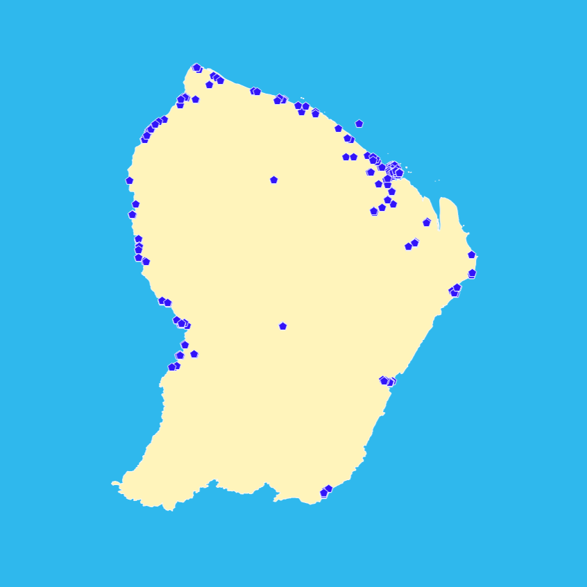
Points d'eau isolés - Guyane 2015 - BD Carthage
Un point d'eau isolé est un point d'eau non susceptible d'être relié au réseau hydrographique ; il s'agit des objets suivants, situés sur le territoire national :
- réservoirs et châteaux d'eau ;
- stations de pompage et de traitement des eaux;
et plans d'eau inférieurs à 1ha.
Un point d'eau isolé est localisé par un sommet géométrique.
Simple
- Date (Creation)
- Edition
-
2015
- Citation identifier
- http://www.sandre.eaufrance.fr/?urn=urn:sandre:donnees:PointEauIsole:GUF:::ressource:2015:::html
- Status
- Completed
- Point of contact
-
Organisation name Individual name Electronic mail address Role SANDRE
Processor AFB
Owner DEAL Guyane
Point of contact
-
external.theme.gemet-theme
-
-
politique de l'environnement
-
- Theme
-
-
EAU DE SURFACE
-
Guyane
-
données ouvertes
-
hvd
-
-
GEMET - INSPIRE themes, version 1.0
-
-
Hydrographie
-
- Place
-
-
FRANCE
-
GUYANE
-
GUF
-
-
external.theme.sie.typologie.nature
-
-
Données de références (référentiels, vocabulaire contrôlé)
-
-
external.theme.sie.typologie.milieu
-
-
Eaux intérieures de surface (rivières et lacs)
-
- Keywords
-
-
BD Carthage
-
-
High-value dataset categories
-
-
Observation de la terre et environnement
-
- Use limitation
-
Licence Ouverte Etalab, https://www.etalab.gouv.fr/licence-ouverte-open-licence
- Access constraints
- Other restrictions
- Use constraints
- License
- Other constraints
-
Pas de restriction d'accès public
- Spatial representation type
- Vector
- Denominator
- 100000
- Language
-
fre
- Character set
- UTF8
- Topic category
-
- Inland waters
))
- Supplemental Information
-
Cette couche de la BD Carthage Guyane ne concerne que le territoire administratif du département de la Guyane. Elle n'a pas été renseignée pour les parties brésiliennes et surinamaises.
- Reference system identifier
- RGFG_1995_UTM_22N / EPSG 2972
- Topology level
- Geometry only
- Geometric object type
- Point
- Geometric object count
- 303
- Distribution format
-
Name Version SHP
inapplicable
MIF/MID
unknown
Distributor
- Distributor contact
-
Organisation name Individual name Electronic mail address Role DEAL Guyane
Point of contact
- Distributor format
-
Name Version ESRI Shapefile
1998
MapInfo TAB
standard
Digital transfer options
- Units of distribution
-
Guyane et bassins frontaliers
- OnLine resource
-
Protocol Linkage Name WWW:LINK-1.0-http--link
https://id.eaufrance.fr/ddd/ETH/2002-1#PointEauIsole Consulter le dictionnaire "Référentiel hydrographique (ETH)" sur le site Sandre
WWW:LINK-1.0-http--link
https://www.sandre.eaufrance.fr/sites/default/files/IMG/pdf/1-DC_BDCARTHAGE_3_0.pdf Consulter le descriptif de contenu de la BD CARTHAGE
WWW:DOWNLOAD:SHP https://services.sandre.eaufrance.fr/geo/eth?SERVICE=WFS&VERSION=2.0.0&REQUEST=GetFeature&typename=PointEauIsole_GUF_Carthage2015&SRSNAME=EPSG:2972&OUTPUTFORMAT=SHAPEZIP Téléchargement des données - Format ESRI Shapefile
WWW:DOWNLOAD:MIF/MID https://services.sandre.eaufrance.fr/geo/eth?SERVICE=WFS&VERSION=2.0.0&REQUEST=GetFeature&typename=PointEauIsole_GUF_Carthage2015&SRSNAME=EPSG:2972&OUTPUTFORMAT=MIDMIF Téléchargement des données - Format MIF/MID
OGC:WFS https://services.sandre.eaufrance.fr/geo/eth? sa:PointEauIsole_GUF_Carthage2015
OGC:WMS https://services.sandre.eaufrance.fr/geo/eth? PointEauIsole_GUF_Carthage2015
- Hierarchy level
- Dataset
- Statement
-
Les points d’eau isolés sont repris à partir de la base de données constituée par la DAF et la DSDS de Guyane, fournis et ont été formatés selon le standard de la BD Carthage
Metadata
- File identifier
- 272c1e2b-20be-4501-9f6c-4e85088906c1 XML
- Metadata language
-
fre
- Character set
- UTF8
- Parent identifier
-
BD Carthage Guyane - 2015
1128cae3-f055-4d95-bdd7-2d4f263237e3
- Hierarchy level
- Dataset
- Hierarchy level name
-
dataset
- Date stamp
- 2024-05-28T15:35:40.263Z
- Metadata standard name
-
ISO 19115:2003/19139
- Metadata standard version
-
1.0
- Metadata author
-
Organisation name Individual name Electronic mail address Role DEAL Guyane
Author
)))